Saturday, September 11, 2010

page31:floor1st

baruch houses-Model
Baruch complex with entrances to each building
scan 01aip
a sketch for scaling down the towers or “breaking” the initial volume into smaller spaces which could distribute among them.
networks_01
diagram of possible paths that people follow. The flow of movement can lead to networks among the buildings which can provide opportunity for reutilized areas.
LES__ers_Community
Sometimes walking through the projects might be confusing since some people want their community to be gated for security reasons, preventing the others to trespass. Since there is not a clear separation of the public and private area some people might feel uncomfortable having others to walk through their “territory”. If every housing complex was gated, then large areas would have worked as barriers to the others.
Basic RGB
So, based at these flows, new forms could emerge.
 scan 03b

mannahatta_3
looking at the topography in the past: where the shore line was and where were the streams.
Public_Bath-lg The_Aquazanies_perform at Astoria Pool_Queens-lg
Public Baths or public swimming pools used to be vital for the city in the past in terms of hygiene. At Baruch houses in specific there was one working until 1970.
baruch houses_streams
So the location of the streams in relation to the idea of public pools can provide new utilities for recreation or a new environmental zone.
scan 11a
concerning the development rights: the height of the buildings could actually increase giving more surface to people.
NYCHA
scan 03ai
structures based on (maybe) the old grid?  incorporating a smaller scale and locality?
scan 02aiold grid with towes
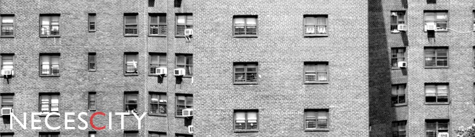
 the facade which reveals the patterns of the whole project
elevation_columbia
patterns building

Wednesday, September 8, 2010

Basic RGB

Corridor and safety

Photo1679 Photo1658

corridor baruch

issues in Baruch Houses

02 sept 10_Page_29_use

Community Centers are vital for this kind of housing since people have somehow to connect and organize themselves and claim their rights as well.

Growing vegetables was not widely spread but at least there were some areas where people were trying to “use” the land. Lenape, the indigenous people in Mannahatta had the “three sisters” garden, which means that they were growing corn, beans and squash.

Sometimes the separation between what is private or public seems to be confusing. Most of the buildings had a fence running around it without any practical reason but just indicating that this surface is owned. People who live there own it but not use it.

pictures from the past where Baruch Houses were developing

02.003.14072 stanton str broomebaruch2.goerck 6a12044r

4129032992_d7484b1e61 15302_10150178578940173_677185172_12172852_5299261_n 15302_10150178578960173_677185172_12172853_1592632_n

building upon erased grid

baruch old houses baruch old new houses
baruch old new baruch solids old new

Tuesday, September 7, 2010

focusing on Baruch Houses in LES

baruch pic 01

Baruch Houses, 1959
2,391 apartments
Total Population 5411

mannahatta_3

the grid then… and now

grids old LES

grids together LES

grids with projects 1 LES

grids with projects LES

from 1950 to 2010

1950_2010

It seems that these projects since their construction didn’t follow the rapid change that happened at the rest of the city. There are actually people saying that it never changed at all.

“not only did the buildings look like each other, they looked exactly the same over the course of decades... no sign of societal change. There was never a new construction or renovation.”

4090701200_329d2d2f92 4745107023_bb993b6f86

the “Wall” of Public Housing

patterns building 01 patterns building

Untitled 1

Projects in LES stretch 2 miles along the East river.
They cover 120 acres and contain 11,300 apartments for 26,000 people.

A woman was saying this: “everywhere we go looks the same. Here is there. There is here. Where is there?”

MAPS


oasis nycha

NYCHA projects at LES

mn3profile_Page_02

The orange color represents the residential area. At the projects it is clear that there is not mixed land use.

oasis land usage

Multi-family residential area

oasis land usage commercial

The black lined areas are the retail zones in the “yellow” residential area.

oasis access to waterfront

The front shore line, which is one of the few green areas in Lower East Side, is actually gated which works as a barrier for some projects there instead of connecting them with the sea.

4c7b47e0_1502_ffffffff

62 HH/Acre or 16sqm per person

oasis color

the area is characterized for the different ethnicities and the cultural diversity

oasis linguistics

Linguistics Isolation (2000)

oasis youth

Youth population

oasis income

Brighter color represents families with income less than $25,000

4c7b3f7c_f98_ffffffff 4c7b3fc3_1012_0

oasis trees oasis water streams

streams and shore line as they were 400 years ago.